
Sun Uk Ka to Route Twisk (Stage 8)
Thursday 23rd February – 3h 12mins – 13.69km
With a random Thursday off, and the Trail Walker event likely clogging up the MacLehose Trail the coming weekend, I tackled Hong Kong’s highest peak – Tai Mo Shan.
‘Tackled’ is perhaps the wrong word, as a lot of the climb is along very gentle, grassy slopes. But if you start as I did, at the foot of the long path up to Leadmine Pass, perhaps it is the right term. Still it was a glorious morning, and I made the sweaty, uneven climb along a sun-dappled path next to a babbling stream.


At Leadmine Pass, tents had been set up, all ready for the weekend’s influx (where people attempt what I started back on January 23rd over the course of a single weekend. The steep climb continues here, back on MacLehose, but soon the trees thin out and spectacular views back to Tai Po, Sha Tin, Shing Mun and Kowloon, even the Island. I could pick out almost all the trails I had done this autumn and winter, with the exception of Lantau, which was covered in a fine haze.


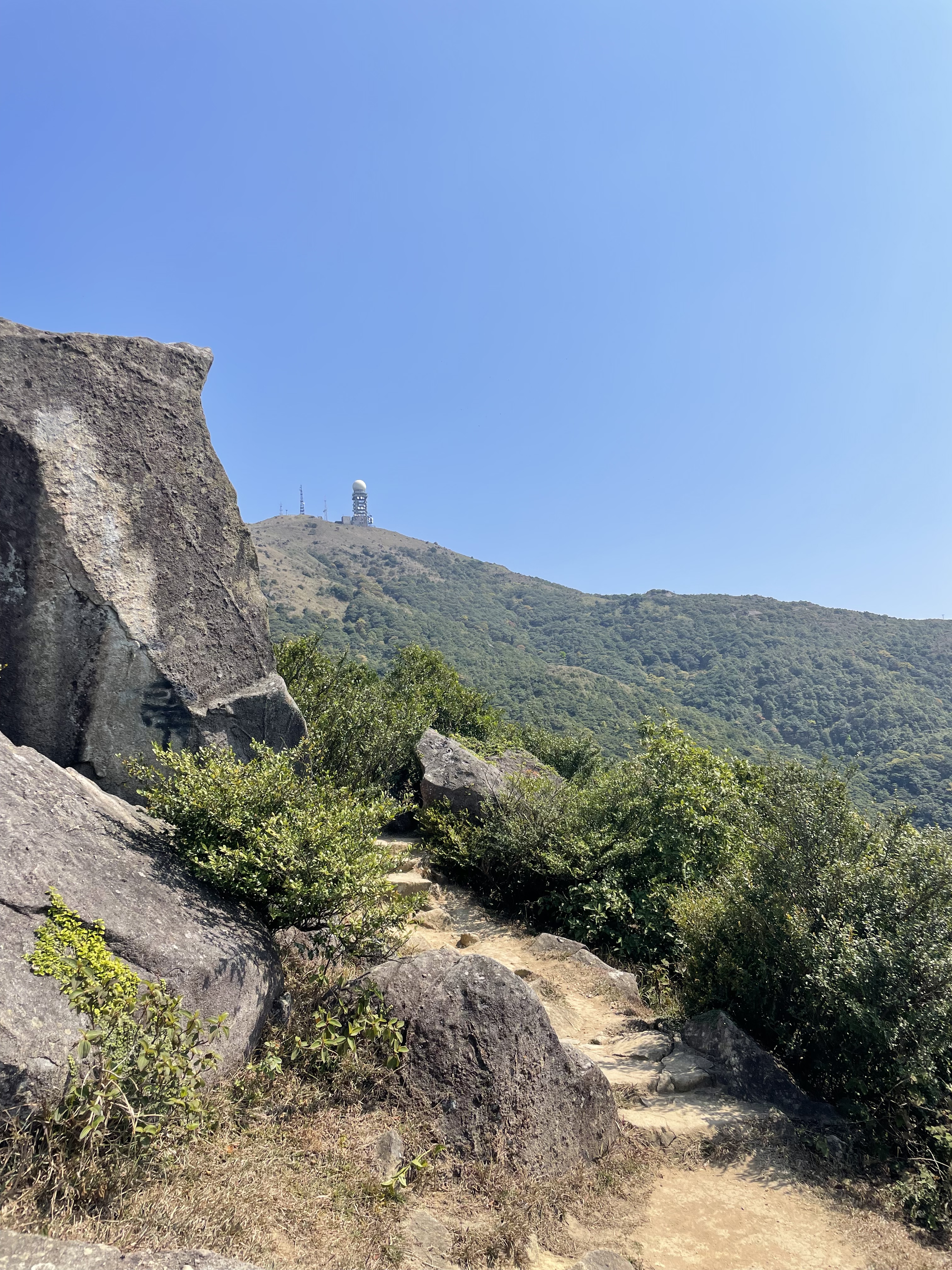
Once the path levels out, you get a landscape seen elsewhere in Hong Kong above a certain height – Sunset and Lantau Peaks and the Pat Sin Leng range spring to mind – one that feels more like a European moor. Huge boulders are strewn at short intervals, presumably from Tai Mo Shan’s days as a volcano, several millennia ago, and small herds of cattle graze lazily by the path. Of all the animals you might encounter on a Hong Kong hike, the buffalo are by far my favourite. Languid chewing and flicking of tails, and barely any acknowledgement as you pass. They own the mountainsides and the beaches, and they know it.


The summit of Tai Mo Shan, the highest point that you can achieve in the territory at just under a thousand metres, is actually quite foreboding. At the top is a government weather station-slash-satellite facility, surrounded by barbed wire and signs forbidding entry. By this point you are on a road, which makes for a smoother climb, though you can’t actually make the very summit.


On the other side of the mountain, the road zigzags down, giving you plenty of time to enjoy the panorama of Tsuen Wan on one side, Yuen Long and even Shenzhen on the other, and plenty of time to be blasted by the sun. As I made my way down, planes started flying low overhead, making their final descent towards Chek Lap Kok. This side of the hill was much busier with hikers and cyclists, as cars can drive almost up to the summit, and I spotted that most Asian phenomenon: the pre-wedding photo shoot. In this case the bride and groom (in full dress) were straddling a motorbike with Tai Mo Shan as the backdrop.

Soon after that the trail leaves the road, and the remainder of the hike is down a fairly mundane path to Route Twisk and a bus that was only six minutes away. And all of a sudden I was just one hike away from finishing the MacLehose, and the Big Four.
